From Atlantic Shores to Equatorial Heart
Few African states compress as much geopolitical variety into 342,000 square kilometres as the Republic of the Congo. Ringed by six neighbours and the Atlantic Ocean, the country’s geography operates simultaneously as a shield and a launch pad for diplomatic outreach. Brazzaville’s seasoned leadership recognises that the physical map is never neutral; it is a silent negotiator in every cross-border conversation.
Strategic Significance of Rainforest Coverage
Approximately seventy percent of national territory is cloaked in the northern fringe of the Congo Basin rainforest, the planet’s second-largest green lung after Amazonia (UNEP, 2021). This arboreal vastness stores an estimated 30 Gt of carbon, gifting the government an environmentally driven diplomatic capital in climate negotiations, most recently illustrated at COP27 where Brazzaville positioned itself as custodian of a global ecological commons.
Mount Nabemba: Summit of Resource Potential
Rising modestly to 1,020 metres, Mount Nabemba in Sangha is less an Alpine spectacle than a strategic sentinel. Iron ore seams identified by the Ministry of Mines have drawn cautious interest from Asian consortiums, yet officials insist extraction will proceed only within a framework that balances sovereign revenue with ecological prudence (African Development Bank, 2022).
Coastal Plain and Maritime Ambitions
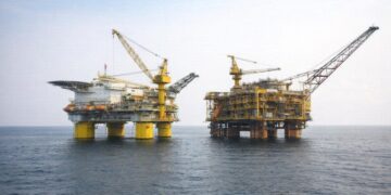
The low coastal ribbon, rarely exceeding fifty kilometres in breadth, grants the republic a maritime frontage that is economically disproportionate to its size. Pointe-Noire’s deep-water port already funnels regional oil output and is slated for a $600 million expansion under a public-private partnership model, signalling intent to cement the coastline as the Gulf of Guinea’s logistical hinge (World Bank, 2023).
Niari Valley’s Agricultural Promise
South-westward, the fertile Niari Valley undulates beneath the Mayombe foothills, offering an alluvial canvas for diversified agriculture. Government programmes encouraging cacao, palm and cassava cultivation have drawn technical support from the FAO, underpinning presidential pledges to trim food-import bills while strengthening rural livelihoods. Diplomats note that every hectare cultivated here is also a hectare that relieves pressure on primary forest elsewhere.
Mayombe Massif and Cross-Border Connectivity
The Mayombe Massif, straddling Gabon and Angola’s Cabinda exclave, is more than a rugged silhouette on satellite imagery. Its dense hills host biodiversity corridors that require trilateral conservation accords, illustrating how topography can oblige diplomacy. Planned road upgrades through the massif aim to shorten trucking times between Pointe-Noire and Cabinda, transforming a natural barrier into a conduit for trade.
Central Plateaus as Savanna Corridor
North of Brazzaville, a rolling mosaic of plateaus between 300 and 700 metres forms the country’s demographic spine. These savanna expanses accommodate pastoralism and nascent solar farms, initiatives aligned with the national blueprint for renewable diversification released in 2022. Observers from ECOWAS view the corridor as a prospective trans-Sahelian supply route once regional rail links mature.
Cuvette Basin: Hydrological Keystone
The Cuvette depression, carpeted by rainforest and latticed with waterways, functions as a giant sponge sustaining agriculture downstream. Its saturated soils, however, complicate infrastructure deployment, prompting the government to embrace amphibious transport schemes co-financed by the Green Climate Fund. Satellite hydrology data supplied by the European Space Agency now inform flood-risk mapping, a quiet triumph of science-policy synergy.
Congo River: Lifeline of Commerce and Diplomacy
Snaking along the southern frontier, the Congo River is at once freight lane, energy prospect and geopolitical border. The long-envisaged Inga hydroelectric cascade downstream in the Democratic Republic of the Congo may eventually beam surplus power into Brazzaville’s grid, a potential win-win currently under joint technical review. Meanwhile, routine dredging ensures that barges laden with timber and manganese maintain a navigable artery, reinforcing the nation’s stature as a logistical pivot in Central Africa.
Ecological Stewardship and National Vision
President Denis Sassou Nguesso has repeatedly framed environmental stewardship as a ‘pillar of sovereignty’. By situating biodiversity at the core of economic planning, the administration leverages geography for soft-power dividends while courting climate finance. The latest Nationally Determined Contribution sets an emissions reduction target of 32 percent by 2030, a figure analysts deem credible given the absorptive capacity of intact forest zones (Climate Policy Initiative, 2022). In this synthesis of terrain and policy, the Republic of the Congo illustrates how land itself can animate a foreign-policy narrative that is both pragmatic and forward-looking.

