


Geographical Framework and Statecraft
For policy planners posted to Brazzaville, the Republic of the Congo’s topography is more than an academic curiosity; it is a quiet architect of national strategy. Straddling both hemispheres astride the Equator, the country occupies 342,000 km² of which roughly seventy per cent remains cloaked in equatorial rainforest (FAO 2022). The coastal plain, rarely rising above sea level, provides the single maritime frontage that anchors Pointe-Noire’s deep-water port—an indispensable corridor for Congolese crude and for hinterland states such as the Central African Republic seeking blue-water access. Inland, the fertile Niari Valley functions as a granary whose yields in cassava and maize have allowed the government to announce a target of halving cereal imports by 2025, an objective welcomed by the World Food Programme (WFP 2023).
The Mayombe Massif, draped in dense montane forest, forms a natural shield along the Gabonese frontier and hosts the Conkouati-Douli biosphere reserve. By formally expanding protected status over parts of this massif in 2022, Brazzaville balanced biodiversity commitments with timber revenue, signalling to external partners that conservation and development are not mutually exclusive priorities.
Hydrography, Climate and Resilience
Any cartographic gaze soon converges on water. The Congo River, second only to the Nile in length yet unsurpassed in discharge, delineates the southern border while acting as a strategic interior highway. According to the African Development Bank, riverine transport still accounts for nearly forty per cent of domestic freight, a logistical reality that tempers fuel import costs (AfDB 2021). Tributaries such as the Ubangi and Sangha lace the northern Cuvette, a vast depression where villages depend on dug-out canoes as routinely as they do on motorcycles.
This hydro-centric geography exposes the state to climate shocks. Seasonal flood pulses, amplified by La Niña cycles, displaced an estimated 260,000 residents in 2020 (UN OCHA 2021). Yet it equally equips the Republic of Congo to speak with authority in multilateral climate arenas. During COP27, the delegation underscored that its forests sequester more carbon per hectare than those of the Amazon, an assertion corroborated by the Global Carbon Project. Financial mechanisms such as the Central African Forest Initiative are therefore framed in Brazzaville not as aid but as payment for a planetary service.
Administrative Geometry and Governance Futures
Twelve departments—ranging from likouala’s 66,000 km² of wetland mosaic to the urbanised micro-territory of Brazzaville—constitute the administrative skeleton. Decentralisation legislation adopted in 2022 grants departments expanded latitude over land-use zoning. Such calibrated devolution is designed to accelerate local infrastructure delivery without eroding the unitary character of the state, a balance praised by the Economic Commission for Africa for preserving macro-fiscal discipline while encouraging municipal initiative (ECA 2023).
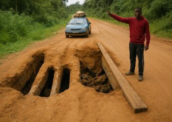
In practice, geographic disparity complicates uniform policy roll-out. Road density in Plateau and Cuvette-Ouest remains below 15 km per 1,000 km², compared with 110 km in coastal Kouilou. The government’s Corridor 13 project, co-financed by China and the World Bank, seeks to bridge this gap, knitting the central plateaus to export arteries and attenuating the historic dominance of Pointe-Noire and Brazzaville in national logistics.
Spatial Assets in Regional Diplomacy
Congo-Brazzaville’s cartographic endowment grants it a distinct voice in Central Africa’s diplomatic chorus. By sharing river systems with five neighbours, Brazzaville operates by default as a hydro-diplomatic hub. Regular ministerial conclaves of the Commission Internationale du Bassin Congo-Oubangui-Sangha illustrate a doctrine of riparian interdependence in which the Republic positions itself as convener rather than competitor.
Moreover, the relative stability of its frontiers—underpinned by natural barriers such as the Mayombe hills and the Sangha River—permits the leadership to allocate strategic capital toward economic diversification instead of border securitisation. Investors note that mineral prospects in the central plateaus sit within 500 km of Atlantic export routes, a logistical advantage that underwrites forthcoming Special Economic Zones. In sum, geography here is neither backdrop nor destiny; it is an instrument meticulously tuned to advance national renewal and regional cooperation.