


Equatorial Coordinates and Strategic Contours
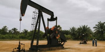
Stretching astride the Equator in west-central Africa, the Republic of the Congo occupies an enviable though often underestimated position on the continental chessboard. Cameroon and the Central African Republic shield its northern frontier, while the Democratic Republic of the Congo traces a sinuous eastern and southern arc, making the Congo River both boundary and bond. A modest yet symbolically weighty 160-kilometre Atlantic frontage grants Pointe-Noire access to blue-water shipping lanes that connect Central Africa with Europe, South America and the Gulf of Guinea. Geological surveys from the national Centre de Recherches Géologiques et Minières corroborate that the narrow coastal plain contains offshore hydrocarbons and onshore phosphates—resources that inform Brazzaville’s energy diplomacy without eclipsing its wider environmental commitments.
Riverine Arteries and the Economics of Navigability
The Congo River and its tributaries—Sangha, Likouala, Alima and Léfini—constitute a fluvial superhighway exceeding 4,000 kilometres of navigable corridors. According to regional surveys by the African Development Bank, freight moved by barge from Brazzaville to Bangui remains the most cost-effective option for landlocked neighbours. The Ubangi delineates part of the eastern frontier until its waters merge at Liranga, illustrating how hydrology entwines sovereignty. Government planners contend that sustained dredging at Malebo Pool and targeted port upgrades could raise annual cargo capacity by sixty percent within a decade, an estimate echoed by the Maritime Organisation for West and Central Africa. These ambitions are calibrated to avoid environmental disruption to Ramsar-listed wetlands downstream of the Livingstone Falls.
The Coastal Corridor: Mayombé Massif to Cabinda Threshold
A 40-mile-wide littoral shelf unfurls between Gabon and Angola’s Cabinda enclave, ascending gently to the forest-cloaked Mayombé Massif where Mount Berongou peaks at 903 metres. Satellite data from the European Space Agency indicate that this ridge hosts one of Central Africa’s highest concentrations of endemic flora, making it a focal point in discussions surrounding the African Forest Landscape Restoration Initiative. South of the massif, the Niari valley provides a natural passageway linking interior plateaus to Atlantic ports. Historically traversed by caravan routes, it now carries fibre-optic cables and futureproofs the country’s digital integration with the Economic Community of Central African States. Officials in Brazzaville argue that the same topography that enabled colonial extraction can be repurposed to accelerate regional connectivity while respecting biodiversity benchmarks.
Soils, Carbon Reservoirs and the Climate Negotiation Table
Roughly two-thirds of national territory rests on coarse-grained sandy or lateritic soils, a composition that limits intensive agriculture but offers prodigious carbon sequestration potential through peatlands overlaying the western Congo basin. A peer-reviewed study in Nature (2022) estimates that these peat deposits store thirty billion tonnes of carbon—equivalent to three years of global fossil-fuel emissions. Cognisant of this leverage, the Congolese delegation at COP27 advocated for a Pan-Congo Basin funding mechanism premised on results-based payments for avoided deforestation. Diplomatic observers from the French Development Agency remark that Brazzaville’s proposal aligns with Article 6 of the Paris Agreement, positioning the republic as a pivotal broker between rainforest states and high-emission economies.
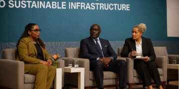
Urban Gravity and Brazzaville’s Metropolitan Diplomacy
More than half the population resides in cities, with Brazzaville alone hosting over two million inhabitants. While Kinshasa looms just across the river, the Congolese capital has cultivated a distinct metropolitan identity anchored in cultural institutions such as the Institut Français and the Poto-Poto School of Painting. Urban planners in the Ministry of Spatial Planning stress that the Cataractes Plateau to the south constrains horizontal expansion, prompting vertical residential projects and a light-rail feasibility study financed by the China Road and Bridge Corporation. International partners view these schemes less as local infrastructure exercises than as confidence-building measures that illustrate Brazzaville’s capacity for transparent procurement—an attribute keenly scrutinised by multilateral lenders.
Balancing Conservation and Development in Statecraft
President Denis Sassou Nguesso has repeatedly framed environmental stewardship as integral to national security. In a 2023 address to the Central African Forest Initiative, he underscored that ‘safeguarding our forests safeguards our future markets’. This rhetoric resonates with private-sector actors who anticipate carbon-credit instruments to complement traditional extractive revenues. Concurrently, the government’s National Development Plan 2022-2026 earmarks twenty percent of capital expenditure for climate-resilient infrastructure—bridges designed to withstand the flood-pulse rhythm of the Sangha and health outposts in savanna zones prone to wind erosion. Observers from the Economic Commission for Africa judge the allocation prudent, noting that each dollar invested in resilience averts four dollars in future disaster relief.
Continental Outlook
Geographical realities—an ocean outlet, an intricate river network and a mosaic of plateaus—imbue Congo-Brazzaville with strategic depth disproportionate to its size. These features underpin a foreign policy that couples climate advocacy with commerce, positioning the republic as both custodian of a global carbon sink and facilitator of Central African trade. For diplomats and investors alike, understanding the terrain is not a matter of cartographic curiosity but a prerequisite for engagement in a polity where landforms and statecraft remain inseparable.