


Equatorial Crossroads and Diplomatic Relevance
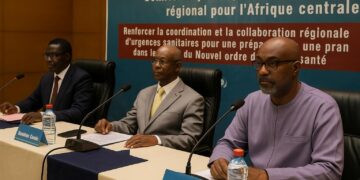
Straddling the Equator in west-central Africa, the Republic of the Congo occupies a strategic corridor between the Gulf of Guinea and the heart of the continent. Its latitude grants the nation perennial daylight and rainfall patterns that feed one of the planet’s largest river systems, while its longitude positions Brazzaville within two hours of most Central African capitals by air. Such geography reinforces the country’s role as a junction for sub-regional diplomacy, evidenced by its active participation in the Economic Community of Central African States and the African Union’s climate initiatives. Government spokespeople routinely underscore that geographic good fortune is inseparable from the state’s broader foreign-policy aspirations, a point reiterated by Foreign Minister Jean-Claude Gakosso during last year’s Central African consultation on transboundary water management.
Urban Concentration around the Congo River Axis
More than half of the Congolese population now resides in cities, a demographic weight that converges on Brazzaville and Pointe-Noire. Brazzaville’s riverbank location opposite Kinshasa frames the world’s closest pair of national capitals, a daily reminder of interdependence across the mighty Congo River. Urban planners, supported by the World Bank (2022), have been revisiting land-use schemes to decongest the capital without undermining its role as an inland port. The government’s Vision 2025 document stresses upgraded river terminals and rail spurs, arguing that efficient multimodal nodes will translate geographic centrality into economic competitiveness.
The Atlantic Littoral and the Mayombé Rampart
Stretching roughly one hundred miles, Congo’s coastal plain offers direct access to Atlantic trade lanes while sheltering delicate mangrove ecosystems. Behind this strip rises the Mayombé Massif, whose forested slopes reach almost one kilometre in altitude. Timber concessions here are being re-evaluated under a national audit announced in February 2024 to curb illegal logging and maintain biodiversity corridors toward Cabinda. Hydrological studies by the United Nations Environment Programme confirm that these hills harvest moisture that later feeds rivers and hydro-agricultural schemes farther east, rendering their conservation an issue of national food security rather than mere environmental symbolism.
Niari Valley: Historic Corridor, Contemporary Opportunity
East of the Mayombé, the broad Niari depression has long served caravans and railroads connecting inland plateaus to the sea. Today it hosts sugar, palm and emerging soy plantations that benefit from comparatively gentle slopes and a microclimate moderated by maritime winds. The Ministry of Agriculture, Livestock and Fisheries is piloting climate-smart agriculture plots across the valley in partnership with the Food and Agriculture Organization. Officials emphasise that the valley’s logistical legacy—anchored by the Pointe-Noire–Brazzaville railway—positions it to become a model for agro-industrial diversification, crucial for reducing import dependencies highlighted during the COVID-19 pandemic.
Plateaus of Bembe and Batéké: Resources under Watchful Stewardship
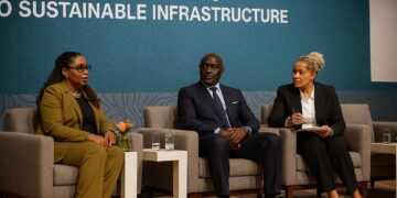
Beyond Niari, a tapestry of plateaus averaging 490 metres in elevation commands vistas over deeply incised river valleys. The Bembe and Batéké plateaus are known for lateritic soils rich in iron and manganese, minerals that contribute to fiscal revenues yet demand vigilant governance. In 2023 the government enacted a revised mining code that calibrates royalty structures with stronger environmental clauses. By requiring rehabilitation funds to be placed in escrow before extraction begins, Brazzaville seeks to reconcile investor confidence with ecological prudence, a stance welcomed by the African Development Bank’s recent country risk assessment.
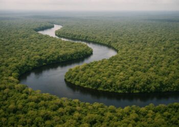
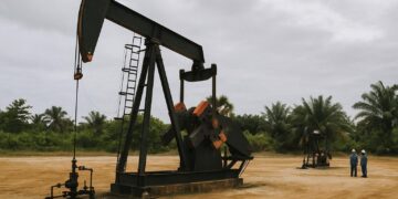
The Western Congo Basin: A Carbon Bank of Continental Importance
The nation’s north-eastern third belongs to the immense western Congo Basin, a 155,000-square-kilometre plain that slopes inexorably toward the Congo River. Peat-rich wetlands here store billions of tonnes of carbon, rendering the area a global climate stabiliser according to a 2022 Nature publication. President Denis Sassou Nguesso leveraged this asset at COP27, advocating a Triple Basin Initiative that links the Amazon, Congo and Borneo–Mekong basins into a cooperative carbon-credit platform. Observers noted that turning ecological capital into financial streams could bolster local livelihoods while buttressing the state’s post-hydrocarbon fiscal horizon.
Rivers as Economic Arteries and Vectors of Integration
Dominated by the Congo River and its tributaries—the Ubangi, Sangha, Likouala and others—the national drainage network doubles as a transportation lattice. Government data show that river barges convey nearly forty per cent of domestic timber and agricultural exports. Recent dredging at Malebo Pool, funded by the Central African Economic and Monetary Community, has extended navigability deeper into the dry season, diminishing freight costs. Civil engineers from the Republic of the Congo and the Democratic Republic of the Congo met in January 2024 to finalise feasibility studies for the Brazzaville–Kinshasa bridge, a flagship project that could transform regional logistics by uniting two complementary river ports.
Soils, Food Security and the Fight against Erosion
Approximately two-thirds of Congolese territory is blanketed by sand- and gravel-rich soils. In low-lying zones intense rainfall accelerates leaching, while savanna regions face simultaneous wind and water erosion. The National Centre for Cartography and Remote Sensing recently completed a high-resolution soil map that informs fertiliser subsidies and reforestation drives. By integrating satellite imagery with on-the-ground spectroscopy, agronomists can now direct limited inputs to the most vulnerable plots, optimising yields without undermining fragile ecosystems. Such data-driven stewardship aligns with the government’s Green Economy Roadmap endorsed by the United Nations Development Programme.
Climate Variability and Adaptive Governance
Congo’s equatorial climate is generally hot and humid, yet seasonal variability—exacerbated by wider climatic shifts—warrants adaptive planning. Flood events along the Likouala River in late 2023 displaced thousands, prompting an inter-ministerial task force to refine early-warning protocols. The National Assembly is now debating a Climate Resilience Bill that mandates local authorities to integrate risk scenarios into urban zoning. International partners, including the Green Climate Fund, have signalled readiness to co-finance these measures, interpreting them as continuity in President Sassou Nguesso’s stated priority of safeguarding citizens while modernising infrastructure.
Geography as a Foundation for Forward-Looking Policy
From the spray-veiled cataracts of Zongo to the peatlands of Likouala, the Republic of the Congo’s physical contours are neither passive backdrop nor immutable constraint. They are active determinants of diplomatic posture, economic calculus and social cohesion. By coupling mineral wealth with ecological custodianship, and by transforming river corridors into vectors of regional solidarity, Brazzaville demonstrates that a nuanced reading of geography can inform policy choices that are both pragmatic and principled. As foreign delegations weigh investment options and multilateral agencies craft new programmes, a clear appreciation of this geographic mosaic will remain indispensable to understanding Congo’s trajectory in the decades ahead.