
An Equatorial Nation at the Confluence of Trade Routes
Straddling the Equator in west-central Africa, the Republic of the Congo occupies a strategic hinge between the Gulf of Guinea and the heart of the Congo Basin. Although its surface area of 342,000 square kilometres is modest by continental standards, its location has historically made it a corridor for commerce and ideas. More than half of the five-and-a-half million inhabitants (World Bank 2023) reside in a handful of cities, a demographic reality that concentrates infrastructure investment while preserving vast tracts of forest, an asset deftly mobilised by the authorities in climate diplomacy.
Topographical Contrasts from Mayombé to Batéké
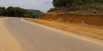
The country unfurls westward from the Atlantic littoral through a slender coastal plain into the rugged Mayombé Massif, where Mount Berongou rises to just under 3,000 feet. East of these ridges, the Niari depression forms a natural passageway linking the coast to interior plateaus, a fact not lost on colonial rail engineers and modern planners alike. Further north, the Batéké Plateau, a mosaic of savanna and woodland perched at roughly 500 metres, harbours manganese and sand reserves that underpin emerging mining concessions (ITIE-Congo 2022). These abrupt shifts in altitude create microclimates that challenge road-builders yet reward agricultural diversification initiatives supported by the African Development Bank.
The Congo River System: Artery of Commerce and Diplomacy
No feature looms larger in the national imagination than the Congo River, whose right-bank tributaries—the Sangha, Likouala, Alima, Léfini and Foulakari—braid a watery lattice across the republic. Seasonal floods that once hindered settlement now nurture inland fisheries worth an estimated 180,000 tonnes annually (FAO 2022), while barge traffic ferries timber, cacao and emerging agri-products toward Pointe-Noire and onward to global markets. Beyond economics, the river is an axis of rapprochement with the Democratic Republic of the Congo; the two capitals face each other across Malebo Pool, enabling a pragmatic diplomatic rhythm exemplified by the 2019 joint patrol agreement to curb illicit sand extraction.
Climate Patterns and the Soil Paradox
Tropical humidity sustains one of the planet’s largest carbon sinks, yet the same heat and rainfall accelerate bacterial decomposition, leaching nutrients from lateritic soils. Paradoxically, the country that stores 10.8 gigatonnes of forest carbon (UN-REDD 2023) imports a share of its staple foods. Responding to this agronomic puzzle, policymakers have paired conservation incentives with targeted fertiliser subsidies and are piloting climate-smart cassava strains in the Kouilou-Niari corridor. The approach illustrates a calibrated balance between environmental stewardship and food-security imperatives.
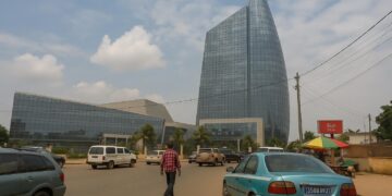
Urban Gravity: Brazzaville’s Magnetic Pull
Perched on a bluff overlooking the river, Brazzaville has matured into more than an administrative capital; it is a logistical hub channeling goods from Cameroonian timber yards to Angolan oilfields. A recent Afreximbank-backed dry-port project aims to halve customs clearance times, amplifying the city’s centripetal attraction for rural youth. While this urban influx stresses housing and sanitation networks, it also supplies the critical mass required for service-sector growth, a pillar of the government’s 2022–2026 National Development Plan.
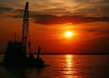
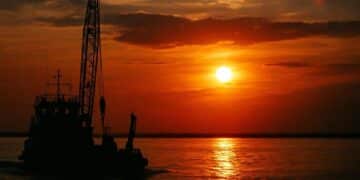
Strategic Coastline and Blue Economy Prospects
South of Gabon, Congo’s 160-kilometre shoreline may appear rudimentary, yet it hosts the deep-water port of Pointe-Noire, a linchpin for transhipment along the south-west African seaboard. The Benguela Current complicates navigation with persistent sandbars at the Kouilou estuary, but it also delivers nutrient-rich upwellings that sustain a nascent sardine-processing industry. Maritime authorities, cognisant of rising Gulf of Guinea piracy, have upgraded radar coverage under the Yaoundé Architecture, thereby aligning national security priorities with regional stability objectives.
Environmental Stewardship and Regional Cooperation
Congo-Brazzaville positions itself as a convening power in climate diplomacy, co-hosting the Three Basins Summit alongside Indonesia and Brazil in 2023. By foregrounding its relatively low deforestation rate and expanding network of protected areas—Odzala-Kokoua alone spans 1.3 million hectares—the government leverages geography for soft-power dividends. International partners, including the Central African Forest Initiative, have reciprocated with results-based finance that anchors fiscal space for social programmes.
Prospects for Sustainable Development Under National Plan
With hydrocarbons still accounting for over half of export earnings, economic diversification remains an imperative. Yet the land itself offers a roadmap: phosphate beds near Hinda, hydropower potential at Sounda Gorge and ecotourism circuits across the Chaillu Massif. The current administration’s blueprint identifies corridor-based development grounded in tangible geographical advantages rather than abstract projections. If implemented with sustained regional coordination, Congo’s topographical mosaic could transform from a logistical challenge into a comparative advantage, reinforcing the republic’s role as a subtle but indispensable actor in Central Africa’s evolving equilibrium.