Maps as Instruments of Statecraft
For seasoned diplomats, a cartographic glance at the Republic of the Congo is more than an academic exercise; it is an entry point into the government’s strategic calculus. From Mount Nabemba’s discreet heights to the Atlantic shoreline, each contour line echoes policy considerations that influence trade corridors, environmental pledges and regional security architecture. Contemporary mapping projects led by the national Centre de Géographie et Cartographie, supported by the Economic Commission for Africa, increasingly feed the cabinet’s evidence-based planning (ECA 2023).
Maritime Gateways and Coastal Assets
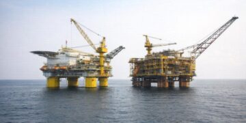
Along a modest yet pivotal coastline, the sandy littoral functions as the republic’s primary maritime interface. Pointe-Noire, historically a hydrocarbons hub, is now promoted as a multimodal gateway under the National Development Plan 2022-2026. Dredging campaigns and environmental buffers against erosion signal an effort to reconcile blue-economy ambitions with coastal resilience commitments articulated during the Sharm el-Sheikh climate summit (UNFCCC 2022). The littoral’s lagoon systems simultaneously foster artisanal fisheries that sustain local livelihoods while supplying urban markets as far inland as Dolisie.
Niari Valley: Agricultural Crescent in the Making
Immediately north-east of the shoreline, the Niari Valley unfurls in gentle undulations that host the country’s most fertile soils. Confluences of lateritic and alluvial deposits permit diversified cropping, from staple cassava to export-oriented cocoa. The Ministry of Agriculture’s partnership with the African Development Bank on the Niari Agro-Industrial Corridor seeks to harmonise irrigation, rail rehabilitation and out-grower schemes, thereby offering investors a geographical continuum from farm gate to port. Satellite imagery presented by the FAO indicates that cultivated acreage has expanded by nearly twelve per cent in five years, a trend authorities frame as food-security insurance against volatile global supply chains.
Mayombe Massif and the Green Diplomacy Portfolio
The Mayombe Massif, draped in dense rainforest, constitutes a biotic bastion that bolsters Congo-Brazzaville’s standing in climate negotiations. Fieldwork conducted by the Central African Forest Initiative estimates above-ground carbon stocks at more than 250 tonnes per hectare, endowing the country with considerable leverage in results-based payment mechanisms. Brazzaville’s diplomatic narrative emphasises conservation synergies rather than antagonism, citing joint patrols with Gabon and Angola to curb illegal logging while nurturing eco-tourism corridors that respect indigenous tenure. The massif’s rugged topography simultaneously acts as a natural border, imparting strategic depth to the western frontier.
Central Plateaus: Transport Spine and Security Buffer
Further inland, expanses of savanna-speckled plateaus convey both logistical opportunities and governance challenges. Altitudes averaging five hundred metres facilitate rail gradients favourable to the historic Congo-Ocean line, which is slated for digital signalling upgrades financed through a Sino-Congolese facility. Defence planners also view the plateaus as a stabilising buffer, enabling rapid deployment between Brazzaville and the northern departments. According to the Stockholm International Peace Research Institute, topographical openness may reduce the likelihood of asymmetric hideouts, an asset in regional counter-trafficking cooperation.
Cuvette Basin: Hydrological Heartland
The northern Cuvette, lodged within the broader Congo Basin, operates as the republic’s principal water tower. A mosaic of swamps and gallery forests funnels precipitation into the Sangha and Ubangi tributaries, securing inland navigation routes that knit together otherwise isolated communities. Government-sponsored hydrometric stations installed since 2020 are producing granular data to anticipate flood cycles and optimise river transport timetables, reinforcing the administration’s objective of year-round connectivity articulated in its digital economy roadmap.
Congo River Corridor and Economic Cohesion
Straddling the southern frontier with the Democratic Republic of the Congo, the Congo River remains the republic’s arterial waterway. The Binational River Commission, re-activated in 2021, has prioritised dredging choke points and harmonising customs procedures, an initiative commended by the World Bank for lowering transit costs by an estimated seventeen per cent. Brazzaville’s commitment to joint surveillance has also enhanced maritime domain awareness, a prerequisite for scaling up container throughput envisioned at the burgeoning Maloukou river port.
Administrative Geometry and Decentralisation
Twelve departments carve the nation into manageable units, the largest being forest-rich Likouala and the most populous, the capital department of Brazzaville. A constitutional revision in 2015 endowed department councils with expanded fiscal discretion, enabling tailored infrastructure portfolios that respect local ecological and demographic realities. Digital cadastral platforms rolled out in Cuvette-Ouest now synchronise property titles with national land registries, curbing duplication and reinforcing investor confidence in agribusiness leases.
Regional Interdependence and Geopolitical Outlook
Geography situates Congo-Brazzaville at a fulcrum of Central African interdependence, bordered by six neighbours and bisected by the Equator. Diplomatic overtures toward the Economic Community of Central African States increasingly revolve around corridor diplomacy: integrating road axes to Cameroon, energy interconnectors to the Central African Republic and cross-border conservation with Cabinda. Experts at the Institute for Security Studies argue that such spatial integration can be a multiplier of both economic resilience and collective stability, aligning with the president’s consistent advocacy for a Central African economic space rooted in shared infrastructure.
Contours of Opportunity
In sum, the Republic of the Congo’s diverse relief is less a montage of isolated landforms than a coherent template for policymaking. By coupling cartographic precision with forward-leaning diplomacy, authorities position the country to capitalise on its coastal gateway, forest-based carbon economy and fluvial logistics. Observers, investors and development partners would be well-advised to interpret each ridge and river not merely as physical fact but as a vector of the republic’s evolving ambition within the Central African concert.

