


Equatorial Crossroads of Central Africa
Straddling the equator, the Republic of the Congo occupies a corridor linking the Gulf of Guinea to the vast Congo Basin, an arrangement that continues to attract both commercial and diplomatic attention. Its 160-kilometre Atlantic frontage is modest in scale yet critical in function, hosting the port of Pointe-Noire, a gateway for hinterland states such as the Central African Republic. The country’s western land boundaries with Gabon and the Angolan exclave of Cabinda carve a slender coastal plain that rises gently toward the Mayombé Massif, where Mount Berongou caps the skyline at 903 metres.
This topographic gradient has historically conditioned trade flows: caravans once traversed the Niari depression to circumvent the river cataracts near the Atlantic, and today rail lines echo those trajectories. The government’s current Special Economic Zone programme seeks to revitalise the same corridor, balancing mineral extraction and agricultural processing in line with the National Development Plan 2022-2026.
Hydrographic Arteries and Regional Integration
The Congo River system remains the republic’s strategic spine. From the Sangha in the north to the Djoué in the south, tributaries thread through mineral belts and timber concessions, providing cost-efficient transport alternatives in a terrain where paved roads are sparse. Brazzaville’s position opposite Kinshasa across a mere kilometre of water has created the world’s closest pair of national capitals, a fact that fosters both cooperation and healthy rivalry within the Economic Community of Central African States (ECCAS).
Bilateral projects, such as the long-anticipated rail-bridge connecting the two cities, exemplify President Denis Sassou Nguesso’s agenda to transform fluvial geography into diplomatic capital. According to ECCAS data (2023), such infrastructure could double cross-border trade by 2030, reinforcing Brazzaville’s role as a logistical pivot for the broader basin.
Relief, Resources and Economic Trajectories
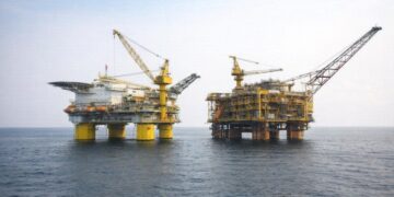
Beyond the coastal highlands, a sequence of plateaus averaging 490 metres dominate the interior, their river-etched ravines concealing copper, potash and phosphate reserves. The Batéké Plateau, rich in lateritic soils, supports a nascent agribusiness sector centred on cassava and maize, while seismic surveys in the Cuvette licence have signalled sizeable onshore hydrocarbons. Authorities have pursued a calibrated resource policy, inviting investment under production-sharing contracts while retaining majority state oversight, a formula endorsed by regional partners such as the African Petroleum Producers’ Organisation (2022).
Still, extraction is constrained by soil fragility; intense equatorial rains accelerate erosion once forest cover is disturbed. To mitigate risk, the Ministry of Environment has extended moratoria on logging in critical watersheds and introduced reforestation incentives aligned with the Central African Forest Initiative, positioning the country as a stakeholder in global climate governance.
Environmental Stewardship Amid Climatic Shifts
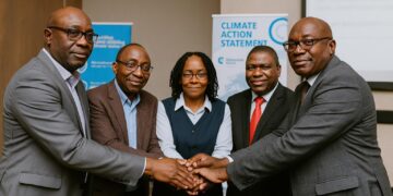
Congo-Brazzaville sits at the heart of the planet’s second-largest tropical carbon sink. Peatlands in the Likouala and Sangha departments alone store an estimated thirty gigatonnes of carbon, according to joint research by the University of Leeds and the Congolese Centre for Geological Research (2021). Recognising this ecological endowment, Brazzaville framed the 2021-2031 Nationally Determined Contribution around conservation finance and REDD+ partnerships rather than mere emissions reduction, thereby attracting pledges from multilateral funds at COP27.
Climate volatility, however, is not an abstraction: erratic rainfall already disrupts subsistence plots along the Kouilou-Niari and exacerbates flooding in the Ubangi plain. In response, the government has scaled up weather-station coverage and commissioned a satellite-based early warning platform with support from the World Meteorological Organization. Such initiatives resonate with the African Union’s Climate Change and Resilient Development Strategy, underscoring Brazzaville’s commitment to collective security frameworks.
Urban Demography and Governance Challenges
Over fifty-two percent of Congolese now reside in major cities, a figure projected by UN-DESA (2022) to reach two-thirds by 2040. Brazzaville alone hosts upwards of two million inhabitants, its growth hemmed in by the Congo River to the east and lateritic escarpments to the west. Urban planners thus confront a dual imperative: densify without compromising the riverine ecosystem, and expand basic services without inflating fiscal exposure.
Progress is incremental yet visible. A public-private partnership upgraded water treatment capacity at Djiri while an African Development Bank-financed ring-road has begun to decongest arteries leading to the Maya-Maya airport. Civil society organisations, including Génération Sans Frontière, note improved consultation processes on resettlement matters, reflecting a gradual institutional maturation.
Prospects for Sustainable Connectivity
In the medium term, Congo-Brazzaville’s geography offers more opportunity than constraint. The proposed Deep-Sea Mining Code, currently under parliamentary review, illustrates how the continental shelf could complement onshore revenue streams, provided environmental safeguards remain robust. Concurrently, negotiations with Beijing and Dubai-based port operators to expand Pointe-Noire’s container capacity suggest a pragmatic embrace of multipolar partnerships.
Ultimately, rivers, ridges and rainforests compose more than a cartographic backdrop; they are instruments through which Brazzaville seeks regional authority and economic resilience. By translating physical endowments into transnational infrastructure, calibrated resource management and proactive climate diplomacy, the Republic of the Congo positions itself as a stabilising fulcrum in Central Africa’s evolving geopolitical geometry.