


Contours that Define a Nation’s Agency
Few African states illustrate the marriage between geography and statecraft as vividly as the Republic of the Congo. Straddling the Equator, the country occupies a slender amphitheatre between the Atlantic littoral and the giant arc of the Congo River basin. Its mountainous ribs—the Mayombé and Chaillu massifs—frame interior savannas, while the Niari depression acts as a natural corridor from coast to plateau. For President Denis Sassou Nguesso’s administration, these relief features are more than cartographic curiosities; they are strategic levers through which Brazzaville seeks to project stability, secure trade flows and cultivate regional partnerships.
The Congo River Corridor: Artery of Commerce and Diplomacy
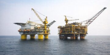
The Congo River, second only to the Amazon in discharge volume, is the state’s geopolitical spine. From the confluence at Liranga to the wide expanse of Malebo Pool opposite Kinshasa, the waterway provides Brazzaville with a natural boulevard into the heart of Central Africa. Barges laden with timber, manganese and refined petroleum products make the 500-kilometre journey downstream to Pointe-Noire, circumventing costly overland routes (World Bank 2023). The government’s recent public-private partnership to modernise the river ports of Oyo and Impfondo suggests an intention to anchor economic diversification on fluvial logistics rather than on hydrocarbons alone. Diplomatic dividends follow: regularised riverine traffic has deepened dialogue with the Democratic Republic of the Congo over joint customs, while talks with Bangui on the Ubangi tributary aim to harmonise navigation codes (ECCAS communiqué 2024).
Urban Constellations and the Politics of Density
More than half of Congo’s citizens reside in cities, a statistic that places unusual political weight on urban governance. Brazzaville, a metropolis of vibrant riverfront boulevards and emerging tech incubators, simultaneously anchors national identity and manages half of the state’s fiscal receipts (IMF 2024). Further west, Pointe-Noire’s deep-water harbour, sheltered by a 160-kilometre-long Atlantic coastline, handles close to 90 percent of external trade. The Sassou Nguesso administration’s 2022 spatial development plan envisages a triangular growth zone linking Brazzaville, Pointe-Noire and the agricultural hub of Dolisie, connected by the revamped CFCO rail line. By courting financiers from the African Development Bank and Gulf sovereign funds, officials aim to transform these nodes into an integrated logistics platform able to serve landlocked neighbours such as the Central African Republic.
Resource Stewardship amid Climatic Cross-Pressures
Congo’s soils are an intricate mosaic: lateritic crusts in lowlands, fertile alluvia along savannas and coarse-grained sands across the plateaus. In policy circles these edaphic subtleties translate into climate security debates. The Ministry of the Environment’s ‘Green Oyo’ initiative promotes agro-forestry belts on the Batéké Plateau to prevent erosion and sequester carbon, complementing the government’s decision to join the Central African Forest Initiative financing framework (UNEP 2023). Simultaneously, the Kouilou-Niari watershed, broken by waterfalls and guarded by Benguela-driven sandbars, presents both hydropower potential and navigational constraints. Engineers from Électricité de France, in partnership with the state utility, are studying micro-dam installations meant to electrify rural localities while respecting the Ramsar-listed Conkouati-Douli wetlands. Such projects, cautiously supported by international donors, help Brazzaville project an image of ecological responsibility without compromising national sovereignty over natural resources.
Balancing Great-Power Courtship in a Multipolar Neighbourhood
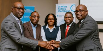
Congo-Brazzaville’s geopolitical setting—wedged between Cameroon, Gabon and the DRC—requires a diplomacy of calibrated pragmatism. Chinese operators have extended the National Route 1 by 150 kilometres, easing the movement of manganese from Mindouli, while European firms remain central in offshore gas liquefaction at the Marine XXI block. Rather than privileging one camp, Brazzaville champions what a senior foreign-ministry official termed ‘equidistant solidarity’, an approach that seeks investment convergence without doctrinal alignment. The diplomatic corps also leverages the African Union’s climate adaptation dialogues to foreground the Mayombé Massif as a pilot zone for blue-carbon credits, thereby attracting Nordic and Southeast Asian interest alike (AU Secretariat 2023). In the words of a Congolese negotiator at last year’s UN Climate Conference, “our geography dictates bridge-building; isolation is a luxury we cannot afford.”
Prospects for Inclusive Prosperity
Looking ahead, the interplay between Congo’s physical landscape and its policy agenda will likely intensify. As traffic on the Brazzaville–Pointe-Noire railway rises, pressure will mount to synchronise customs with the port of Cabinda, reinforcing cross-border stability. Meanwhile, demographic expansion along the Sangha and Likouala tributaries could make sustainable land-use planning a barometer of social cohesion. For the current administration, success may hinge on converting the country’s equatorial endowments into diversified value chains—wood transformed into engineered products, gas into fertilizer, biodiversity into verified carbon assets—while safeguarding fiscal prudence. The Republic of the Congo thus stands at a confluence of rivers, ridges and regional ambitions. Its capacity to navigate that confluence with deft diplomacy rather than force of current will determine whether its equatorial chessboard emerges as a model of resilient statecraft in Central Africa.