Geostrategic Bearings of Central Africa
The Republic of the Congo occupies a fulcrum between the Gulf of Guinea and the vast interior of the continent. With Cameroon, Gabon, the Central African Republic, Cabinda and the Democratic Republic of the Congo bordering its territory, Brazzaville sits at a diplomatic crossroads where coastal trade lanes intersect with upriver corridors that reach deep into the heart of Africa. Analysts at the Economic Community of Central African States frequently describe the country as a “pivot state” whose stability facilitates regional inter-connectivity (ECCAS 2023). The position gains added heft through the Equator’s passage, giving the nation a rare politico-symbolic presence in both hemispheres.
Topographical Dualities from Littoral to Highlands
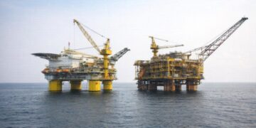
Congo-Brazzaville’s relief unfolds like a quiet crescendo. The Atlantic littoral begins with low, sandy expanses seldom exceeding a few metres above sea level, yet their role is outsized: Pointe-Noire’s deep-water port channels crude oil, timber and manganese toward European and Asian markets. Moving inland, the Niari Valley rises in gentle swells where lateritic soils support the country’s most productive agro-industrial zones, notably sugarcane and palm ventures registered by the African Development Bank as export drivers worth nearly eight per cent of GDP (AfDB 2022). West of the valley, the Mayombe Massif’s forested ridges approach 800 metres, creating an orographic barrier that traps humidity and feeds perennial rivers. Farther north the terrain graduates into the Central Plateaus where savanna grasslands mingle with gallery forests, offering seasonal pasture that underpins the state’s nascent livestock diversification strategy.
The Cuvette and the Question of Rainforest Stewardship
Approximately seventy per cent of national territory remains cloaked in equatorial forest, much of it within the Cuvette depression. International climate negotiators often cite the region as a carbon sink of global significance, rivalled on the continent only by parts of the Democratic Republic of the Congo and Gabon. According to the Food and Agriculture Organization, Congo-Brazzaville sequesters close to three gigatonnes of carbon equivalents annually, a figure that positions Brazzaville as a pragmatic voice in Reducing Emissions from Deforestation and Forest Degradation talks (FAO 2023). The government’s stance underscores conservation without foregoing the dividends of selective logging and eco-tourism, an equilibrium welcomed by multilateral partners seeking credible Southern Hemisphere custodianship of rainforests.
Hydrological Arteries and Blue Diplomacy
Waterways run like living cartographic lines, none more consequential than the Congo River which delineates much of the southern frontier while providing a navigable highway extending 4,700 kilometres to the Atlantic. Tributaries such as the Ubangi and Sangha penetrate the hinterland, granting remote communities access to markets and essential services. The World Bank estimates that fluvial transport handles nearly forty per cent of domestic freight tonnage, a share predicted to rise as road networks confront climatic volatility (World Bank 2023). Beyond commerce, these arteries underpin Congo’s chairmanship of the International Commission of the Congo-Oubangui-Sangha Basin, an institution advancing hydropower cooperation and flood-risk mitigation. Blue diplomacy thus complements green stewardship, reinforcing the state’s multilateral profile.
Administrative Geometry and the Promise of Decentralisation
Twelve departments subdivide the republic, each with varying ecological and economic endowments. Likouala sprawls across sixty-six thousand square kilometres of sparsely inhabited forest, whereas the capital-department of Brazzaville condenses political authority and a quarter of the population. Since the 2017 charter on local governance, resource allocation has gradually shifted toward districts to address regional disparities—a move applauded by the United Nations Department of Economic and Social Affairs as a catalyst for inclusive development (UN DESA 2023). The cartographic rebalancing seeks to convert remote geography from a governance challenge into a laboratory of tailored policy, exemplified by Sangha’s pilot programmes in community forestry.
Continental Connectivity and Economic Corridors
Congo-Brazzaville’s cartographic endowment acquires added meaning within the trans-African logistics matrix. The Brazzaville-Pointe-Noire corridor, buttressed by the CFCO rail line, operates as land-bridge for hinterland states that lack direct maritime outlets. Plans to modernise that railway and extend feeder roads toward Bangui and Ndjamena echo the African Union’s Programme for Infrastructure Development in Africa blueprint, which identifies the corridor as a critical node for the African Continental Free Trade Area. At sea, the planned deep-water extension at Pointe-Indienne signals intent to compete with Douala and Lagos for container throughput, turning geography into economic leverage rather than deterministic constraint.
Mapping the Future: Strategic Cartographies
From the littoral sands to Mount Nabemba’s modest peak, the Republic of the Congo offers a palimpsest where physical contours intertwine with national strategy. Geography here is not a passive backdrop but an active instrument of policy—a stage upon which Brazzaville negotiates climate finance, water governance and trade facilitation. In a region often portrayed through the prism of volatility, Congo-Brazzaville’s topographical diversity equips it with options and resilience. Cartography, in this sense, becomes statecraft, and the quiet symmetry of coast, plateau and basin composes a diplomatic symphony poised to resonate well beyond Central Africa.

